A Wanderlust Adventure offers the closest rafting to Estes Park and Fort Collins. It takes about 80 minutes to drive to our location from Estes Park.

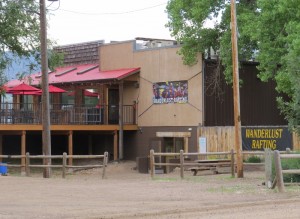
Lower Lot on Right Side of Vern’s. Park Here.
Directions From Estes Park to A Wanderlust Adventure Rafting:
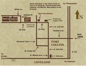
Go 32 miles east on Hwy 34 to N. Wilson Ave in Loveland, look for Jax Outdoor Gear and Safeway. Turn left. Go 10 miles on Wilson Ave. which becomes S. Taft Hill Rd. Turn left onto W. Drake Rd. Go 1 mile. Turn right onto Overland Trail. Go 5 miles. Turn left on CR 54G, look for the Shell Gas Station. Go 1 mile to Galway Drive and turn right. Take the next left on White Lane. Drive about 100 yards and pull into the gravel parking lot on the left. We are located in the lower level of Vern’s Restaurant under the big Wanderlust Rafting sign. About 80 minutes. A Wanderlust Adventure offers the closest rafting to Estes Park.

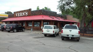
Front of Vern’s (Please do not park here)
Directions From Denver and Fort Collins:
I-25 to Exit 269B. Go 6 miles on Mulberry Street to Overland Trail, turn right. Go 3 miles to CR 54G. Look for Shell Gas Station across the road and to the right. Turn left on CR 54G. Go 1 mile to Galway Drive and turn right. Take the next left on White Lane. Drive about 100 yards and pull into the gravel parking lot on the left. We are located in the lower level of Vern’s Restaurant under the big Wanderlust Rafting sign. About 80 minutes from Denver. We are located 15 minutes from CSU and Old Town Fort Collins.
Below is a Google Map of our location. Click Directions and choose a starting point.

